
-
About
-
Product
-
Solution
-
Support
-
News
-
Join
 PubDate:2023-06-01
 ViewNum:86
It's raining, it's raining again
The weather has been really strange lately!
Sometimes it's sunny and sometimes it's raining
Sometimes it's hot and sometimes it's cool
The seasons are now more distinct
merely
These changes will be in
Take turns in just a few days!
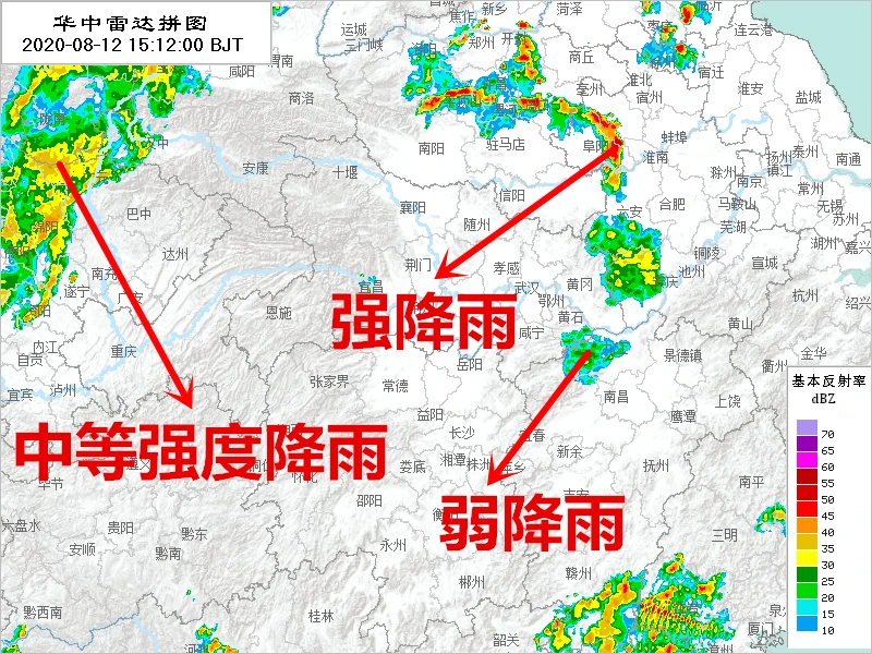
Heavy rainfall is concentrated in Hubei, Anhui and Henan today
Tomorrow the rain area will be carried north to the Huanghuai area of North China
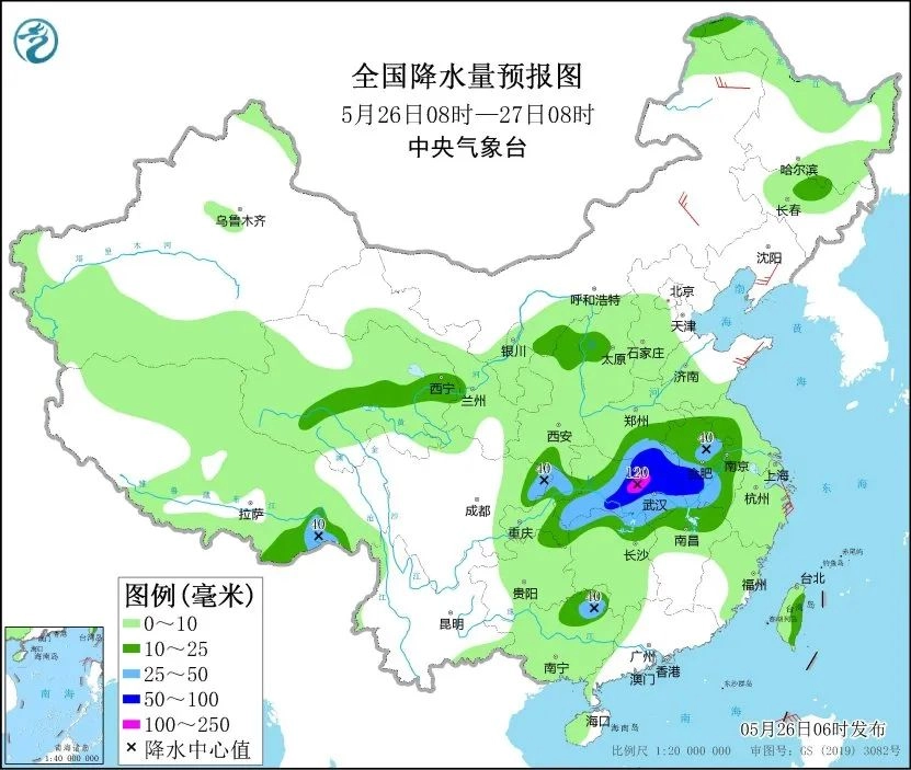
Moderate to heavy rain is expected in southern Henan, Anhui, central and northern Chongqing, Hubei and northern Hunan on Sunday, while heavy or heavy rain is expected in some parts of southern Henan, central and northern Hubei, and southwestern Anhui.
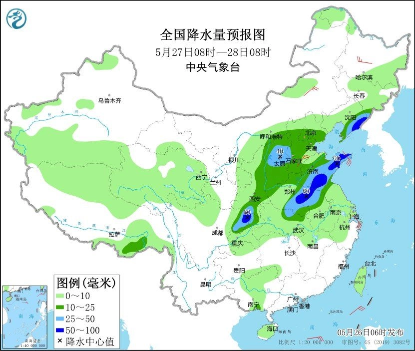
On the 27th, the rain area was further lifted north, and it is expected that North China, Huanghuai and southeastern Liaoning will have moderate to heavy rain and local heavy rain. The day after tomorrow, the rain area will fall to the south, and the intensity will be significantly weakened.
In our lives
In addition, listen to the weather forecast
Know weather changes in advance
Sometimes, you can also look at the official website of the weather observatory
Real-time radar echo
Listen tall Shang!
In fact, it is very simple
Zero foundation teaches you to read radar charts!

Before the Second World War, it was found that precipitation particles such as rain, clouds and snow could generate echoes when detected by military radar, and could better reflect the structure and changes of cloud and rain areas. Therefore, radar as a means of human understanding of nature came into being, and gradually formed radar meteorology.
Radar echo is the detection and reception of radio waves emitted by the radar and scattered or reflected back from the target. These waves are converted into signals that display images on the radar screen, called radar echo maps.
Here's a colorful picture
It's called a radar echo
▽▽
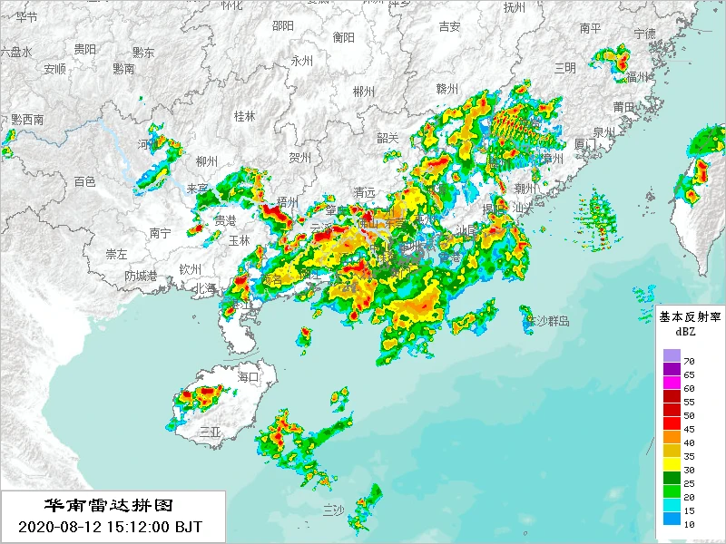
What do weather radars and echograms do?
The application of weather radar and analysis of radar echo map can detect and warn the intensity, location and movement of typhoon, thunderstorm, rainstorm, squall line, hail, tornado and other severe weather in time. It has received good results in disaster prevention and resistance, economic construction and national defense construction.
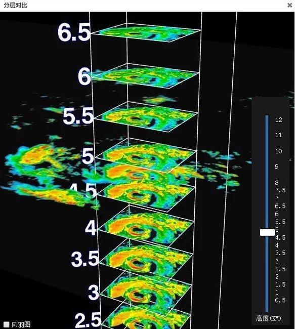
Attention! High energy warning ahead ~~~
Teach you to be a weather expert!
Learn to look at the radar map, when the rain starts, when it ends, the intensity of the rain, at a glance.
How to identify rain zone extent?
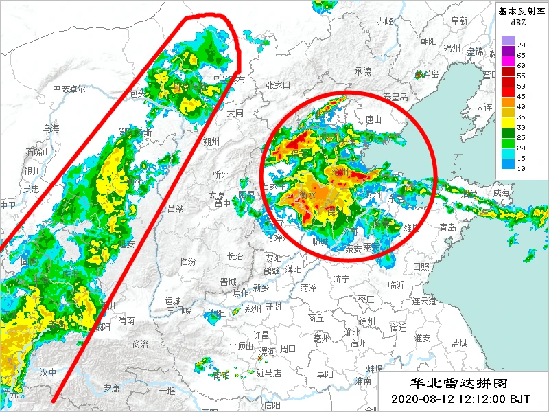
On the radar echo map, the area surrounded by the green echo is generally expected to rain.
How to identify rainfall intensity?
The blue echo corresponds to an area covered by precipitation clouds, but no rain has yet occurred.
From green - yellow - red - purple, the rainfall intensity gradually increases:
When it is green, it means that the local area is "immersed" in continuous drizzle.
Yellow, the rain has made people feel a little urgent, the rain will wet your pants.
Red, the rain is pouring down, the umbrella may not be able to hold, but also may be accompanied by short-term thunderstorms, wind, hail and other strong convection weather.
Purple, covered with purple echo "area precipitation intensity is the largest, the region is" falling "in heavy rain, even heavy rain, and may be accompanied by lightning and wind and even hail and other violent weather.
How to identify future rainfall trends?
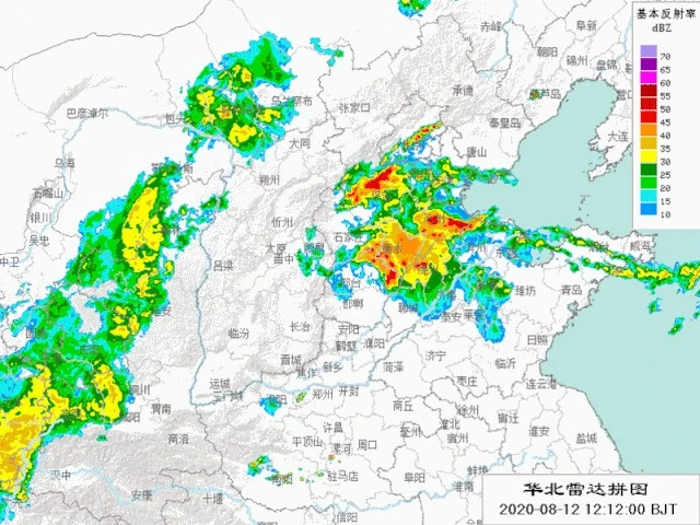
From 12:12 to 14:06 in the North China radar dynamic puzzle, it can be seen that there are two bands of rain moving slowly to the northeast, with little change in intensity.
From the dynamic graph, if the echo of a place changes from blue to purple, it means that the echo intensity is from small to large, and the rainfall intensity is also gradually increased. From the moving trend of the rain belt, you can also roughly judge when it rains and when it stops


 WeChat
 T1-11F, Herui Science and Technology Park, Binjiang District, Hangzhou City, Zhejiang Province