Authoritative Certification Opens the Gate to Official Meteorological Market Access
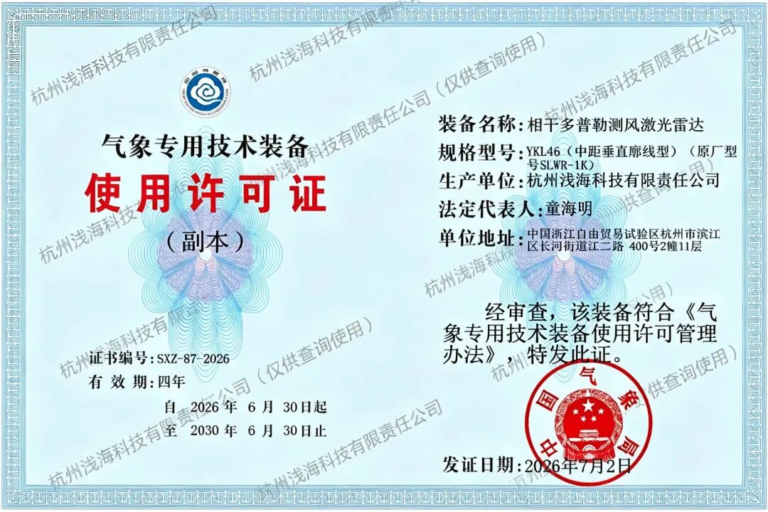
The Permit for Special Meteorological Technical Equipment serves as the core "passport" for domestic meteorological observation equipment to be put into industrial application. As the issuing authority, the China Meteorological Administration (CMA) carries out rigorous rounds of field tests and reviews covering multiple core indicators including detection accuracy, operational stability, environmental adaptability and data reliability of the equipment.
Shallow-seaTechnology’s YKL46 Coherent Doppler Wind LiDAR successfully passed the full review process this time, which verifies that the technical performance of the product fully complies with the specifications stipulated in the Measures for the Administration of Permits for Special Meteorological Technical Equipment. Its detection data meets the official standards for operational meteorological observation, serving as the most valuable authoritative endorsement of the company’s technical prowess in low-altitude atmospheric detection products.
1km Medium-Range Profiling LiDAR Captures Low-Altitude Wind Field Data with High Precision
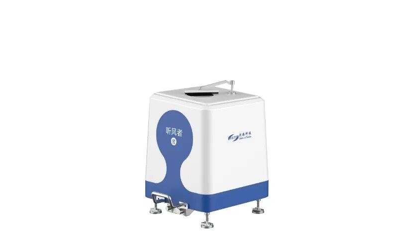
The certified SLWR-1K (YKL46) medium-range vertical wind profiling LiDAR is a flagship product developed by Qianhai Technology for low-altitude atmospheric environmental observation:
✅ The certified SLWR-1K (YKL46) medium-range vertical wind profiling LiDAR is a flagship product developed by Qianhai Technology for low-altitude atmospheric environmental observation:
✅ Equipped with coherent Doppler detection technology, it accurately analyzes the vertical distribution of wind speed and wind direction, and captures subtle changes in local turbulence and air currents.;
✅ It boasts strong environmental adaptability and supports round-the-clock continuous operation in diverse scenarios including park meteorological monitoring, airport general aviation, wind farm operation & maintenance, and airspace management for low-altitude economy.
✅ It outputs meteorological data in standardized formats, enabling seamless connection to operational platforms of meteorological authorities at all levels and rapid integration into existing observation network systems.
Leveraging the R&D and industrial location advantages of the Hangzhou Pilot Free Trade Zone, Qianhai Technology has long been deeply engaged in the atmospheric remote sensing detection sector, continuously upgrading a full range of meteorological observation equipment including wind LiDARs, microwave radiometers and disdrometers. The acquisition of this permit officially qualifies our medium-range wind LiDAR products for legal participation in bidding for meteorological system projects and deployment at operational observation stations.
Expand Layout in Low-Altitude Meteorology to Empower Digital Observation Across the Industry
Driven by the rapid growth of low-altitude economy, smart meteorology and general aviation industries, market demand for refined low-altitude wind field observation has surged continuously.
Taking this national-level qualification as a new starting point, Qianhai Technology will, on the one hand, continuously optimize the detection algorithms and hardware performance of its 1km wind lidar, and launch customized observation solutions adaptable to more complex scenarios. On the other hand, the company will accelerate the market rollout of meteorological licensed products. By partnering with local meteorological bureaus, general aviation parks and other collaborators, we will build high-density low-altitude wind profile observation networks, supplying high-precision meteorological observation data for weather forecasting, airspace safety, wind energy assessment, disaster prevention and mitigation, and other applications.
Moving forward, Qianhai Technology will remain committed to the R&D and quality control of meteorological equipment. Leveraging a full range of authoritative qualifications, we will continuously expand our atmospheric observation product portfolio. With robust core observation technologies, we will fuel the high-quality development of domestic smart meteorology and low-altitude economy industries.



 PubDate:2026-07-02
 ViewNum:279
 Next:Focus on Global Early Warning Event | Shallow-sea Technology Attends the 2nd International Training Course & Equipment Exhibition on AI-enabled Public Early Warning, 2026



 WeChat
 T1-11F, Herui Science and Technology Park, Binjiang District, Hangzhou City, Zhejiang Province


